
AROUND THE GURK SPRING
ROUND HIKE ON THE HOCHRINDL
Tourdates
Walking time without breaks: 6 hour
Altitude difference: 1.000 m
Total length: 21 Km
Difficulty: demanding
+43 4279240
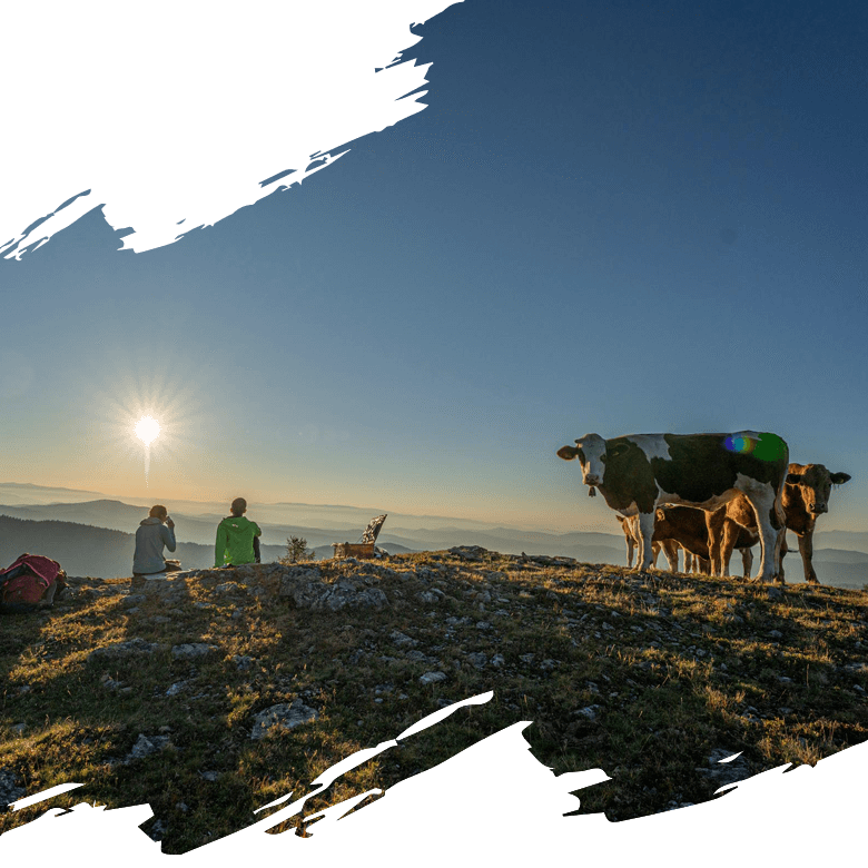
While the lakes in the valley still invite us to swim, we want to refresh ourselves at an altitude of almost 2,000 metres and let the cool autumn air blow around our ears. Without further ado, we arrange to meet Gerlinde Schnitzer-Zarre from the Hochrindl Ski School, who promises us a particularly beautiful circular hike in the Nockberge mountains: once around the Gurk source. Via Sirnitz we reach Hochrindl at 1,670 m, where Gerlinde, a proven connoisseur of the area, warmly welcomes us. Equipped with hiking poles, rucksack and a snack, we begin our tour together along the Alpine Panorama Trail towards Weißes Kreuz. After the first ascent we reach the Pölling (1,750 m). A wide, flowering alpine landscape in a valley basin spreads out before us.
"Over there," says Gerlinde, pointing with her hiking stick to the opposite range of hills, "that's where we see our hiking trail, which stretches in a wide arc over numerous gently curving peaks."
Even before I consider whether the tour we have set out on might not be a bit long, we reach the Hoishütte. This gem lies in the shade of the Swiss stone pines and has a cool beer ready for us from the water trough. At the White Cross, below the Haidnerhöhe (1,799 m), Gerlinde tells us that on this spot, where the cross now stands, a dairymaid once died with her animals in a snowstorm and met the white death.
AROUND THE GURK SPRING
AROUND THE GURK ORIGIN Over the gentle mountain ridge, which only leads slowly upwards, we reach a rustic Alpine Club shelter below the Lattersteig. "It offers shelter if a thunderstorm comes up" Gerlinde explains. It offers us an enjoyable opportunity for a snack, because with the hut we have also reached almost half of our tour. We try the air-cured Gurktaler Speck and the spicy alpine cheese. To the east in the valley basin below us we see two cirque lakes with the so-called Gurk- and Torersee. "This is where the Gurk river rises," Gerlinde explains, "it meanders for 157 kilometres and flows into the Drau at Völkermarkt, Carinthia's second longest river.
It is very quiet around us, a few marmot whistles can be heard in the distance. "Auf-auf!" Gerlinde finally urges us on, because she wants to show us something: To the right of the hut, where the rocky Lattersteig begins and becomes quite steep via a narrow little path, we discover traces of old cartwagons. A mule track. "However," Gerlinde explains "this is not the official trade route, this is where the smugglers' route ran in the clandestine exchange of goods between north and south with wine and salt."
HIGH ABOVE THE PEAKS
We reach the summit cross of the Bretthöhe (2,320 m) via a challenging climb. From its crest line we look down sublimely over the slopes of the Gurktaler Alps. With the best view of the cams all around, the panorama extends all the way to the Julian Alps.
We have reached the highest point of our hike. Behind us we see in a wide arc the distance we have covered and the metres of altitude we have proudly admired. Ahead of us, the path now becomes gentler again. The Große and Kleine Speikkofel (2,270 m/2,109 m) are quickly reached and with the beguiling scent of Speik in our nostrils we cross the alpine pastures downhill towards St. Lorenzen and in a left turn towards Hochrindl. We reach the lowest point when crossing the Gurk in the Seebachern nature reserve (1,407 m). The Gurk meanders beautifully through the untouched nature here. Gerlinde advises us to stop and enjoy one last time, because the last two kilometres will take us up another 200 metres in altitude through the forest and back to the car park, where we conclude our tour with a cool beer at the Almengasthof Stoichart.
By Alexandra Kimmer

